San Diego Area and Southern California Geologic Maps

Mapping San Diego – An Introduction to the Historic Map Archive
The San Diego Association of Geologists (SDAG) is pleased to be able to present this set of geologic and topographic maps covering all or part of San Diego County, California, as a service to our Members and to the general public. This map archive project was deemed necessary and timely for several reasons, including the increasing fragility of the older maps of this region; the “mysterious” disappearance of map plates from the pockets of public and university library volumes over the years; the recent availability of scanning and information storage technology that allows such a collection of archived maps to be accessible at reasonable cost; and early 21st Century computer technology that allows the user to open and use these necessarily large graphics files and to apply them using Geographic Information System (GIS) and other cartographic software.
Using the technology now available, it is possible to preserve for future generations of scholars the wealth of observations and history represented by this collection of antique and out-of-print geologic and topographic maps. With geo-referencing, these maps are now made even more useful to industry and academic work than the original paper copies. SDAG is pleased to stand at the cutting edge of preserving and disseminating these historic maps for our members and colleagues, in service to the public interest.
Contact Greg Cranham or David Bloom or (619)524-6967 for more information.
San Diego area geologic maps from State of California https://www.conservation.ca.gov/cgs/rgm .
Links at the above site allow the download of PDF files of nearly 50 7.5' geologic quad maps from Southern California (download file sizes generally less than 6Mb). This page also gives a link to Oceanside and San Diego 30'x60' regional quadrangle maps.
U.S. Geological Survey Open-File Report 2004-1361 PRELIMINARY GEOLOGIC MAP OF THE EL CAJON 30' X 60' QUADRANGLE, SOUTHERN CALIFORNIA
Compiled by Victoria R. Todd, 2004
Download it at: http://pubs.usgs.gov/of/2004/1361/
San Diego Regional Geologic Model. Jerome Jaminet working with Eric Frost at SDSU and the San Diego Supercomputer Center (see SDSC's GEON project http://www.geongrid.org/) has been developing a system to make it easier to obtain and share useful geologic data and to build up new referenced materials for the San Diego region.
Mr. Jaminet would like input from practicing geologists on an ongoing basis. SDAG members may contact him on how this project could most benefit geologists in the region.
Contact Info: Jerome Jaminet, Jr., Senior Project Scientist, TRC, 9471 Ridgehaven Court, Suite E, San Diego, CA 92123, (858) 505-8881, (858) 505-9515 fax, jjaminet@trcsolutions.com
Point Loma Book. SDSU Professors Pat Abbott and Thomas Rockwell authored a chapter on the geologic history of Point Loma titled "From Sea to Shore" in a new book titled Understanding the Life of Point Loma, published by the Cabrillo National Monument Foundation. The 184-page paperback retails for $16.95. For more information on Cabrillo National Monument visit http://www.nps.gov/cabr
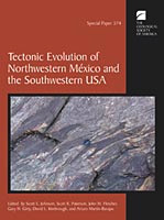 |
"Tectonic Evolution of Northwestern Mexico and the Southwestern United States", 2003, Geological Society of America Special Paper 374 (471 pages). Editors: Scott E. Johnson, Scott R. Paterson, John M. Fletcher , Gary H. Girty, David L. Kimbrough, and Arturo Martin-Barajas. This volume was assembled as a dedication to the career achievements of R. Gordon Gastil. The papers focus primarily on the Mesozoic and Tertiary tectonic evolution of Baja California and nearby regions of mainland México and southern California. The volume begins with an extensive tectonic overview with the goals of summarizing our present understanding of the geology of Baja California, addressing several controversial issues and providing a framework for more detailed discussions in some of the remaining papers. The volume contains a wealth of modern analytical data and authoritatively explores regional issues. The accompanying CD-ROM contains valuable geochronological and geochemical data, color images, and out-of-print Geological Society of America maps. In particular, the CD-ROM contains the highly sought after geologic maps of northern Baja California published by Gordon Gastil and colleagues in 1975 as part of the Geological Society of America Memoir 140, Reconnaissance Geology of the State of Baja California. Order SP 374 for $76.00 (member) or $95.00 (non-member) at the GSA online bookstore: http://rock.geosociety.org/bookstore/
 Professional Paper, "Geology and Paleontology of Palos Verdes Hills, California" - Maps Digitized. Mark Legg and Dick Brown have scanned the color maps in the Woodring, Bramlette and Kew (1946) classic Professional Paper,
"Geology and Paleontology of Palos Verdes Hills, California". These maps are available on two CD's. We are making them available for $10 each, $20 for both. The CDs include the large geologic map and two smaller detailed geologic maps and the large map of the Pleistocene terraces. These are all the maps in the pocket of the publication. They were scanned at 300 dpi, and are in both TIF and PDF formats on the same CDs.
Professional Paper, "Geology and Paleontology of Palos Verdes Hills, California" - Maps Digitized. Mark Legg and Dick Brown have scanned the color maps in the Woodring, Bramlette and Kew (1946) classic Professional Paper,
"Geology and Paleontology of Palos Verdes Hills, California". These maps are available on two CD's. We are making them available for $10 each, $20 for both. The CDs include the large geologic map and two smaller detailed geologic maps and the large map of the Pleistocene terraces. These are all the maps in the pocket of the publication. They were scanned at 300 dpi, and are in both TIF and PDF formats on the same CDs.
To order the CDs e-mail Dick Brown at dickbrowngeo@adelphia.net,
call (562) 598-0595, or write to: Dick Brown, 296 College Park Dr., Seal Beach, CA 90740. Include your mailing address, describe which CD (or both) and send a check, payable to "Arthur R. Brown", for $10 (for one CD) or $20 (for both CDs).
Tom Dibblee Maps
The Santa Barbara Museum of Natural History Dibblee Geology Center presents ten new Tom Dibblee maps of the San Francisco Bay area and the San Joaquin Valley region created by legendary Thomas W. Dibblee. This set will complete a major section of northern California mapped by Dibblee himself. The process of digital map-making enables the Dibblee Geology Center to complete maps in a timely manner while preserving the integrity of Dibblee's work.
Over the course of 75 years, Dibblee created maps that have been instrumental in understanding California's geology. Dibblee, who personally mapped more than a quarter of the state of California - from the Mohave Desert to the Santa Cruz Mountains - remained actively involved in the publication of each new map until his death in November, 2004. The magnitude, integrity, and permanence of Dibblee's geologic mapping are truly unprecedented and legendary which is why it is the first priority of the Dibblee Geology Center to complete the publication of Tom's maps.
Dibblee maps are renowned for their high quality and serve a diverse group of users such as engineering geologists, oil companies, U.S. Forest Service, environmentalists, and students, among others. To date, the Dibblee Geology Center has released 419 maps.
To purchase Dibblee maps go to the Museum's online store at http://store.sbnature.org/catalog/ or the Museum's Gift Shop at 2559 Puesta del Sol Road in Santa Barbara or call (805) 682-4711, ext. 122. Dibblee maps are available rolled or folded ($20.00 plus tax) - shipping and handling are additional if ordering online or by phone. Regional map bundles may be purchased at a bulk price and guide books are also available. For more information on bulk/discount orders contact John via email at dibbleemaps@gmail.com or call 805-231-8080.
NASA World Wind (http://learn.arc.nasa.gov/worldwind/) is free software recommended by Dr. Monte Marshall if you have broadband connection. "You can overfly the WHOLE world!!" - Dr. Marshall
AAPG Bookstore sells for $38 the Whittier Canyon digital dataset for LA Basin www.aapg.org (free login required). Also an interesting trial to serve data up on the web (GIS-UDRIL). Regards, Andrew Zolnai +1 909 798 2853 |